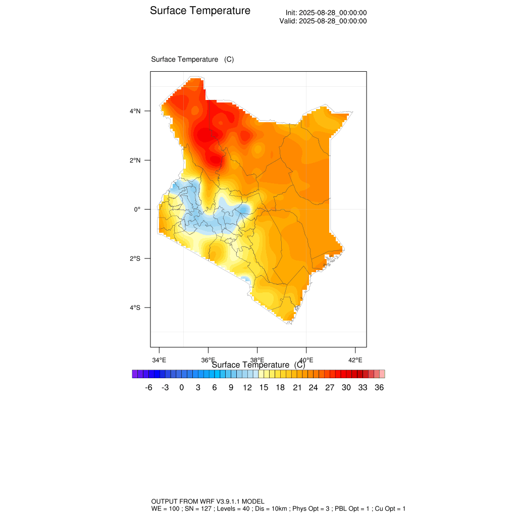
Temperature forecasts for 28 August - 7 September 2025
Blog
written by Zipporah Njeri
The Kenya Space Agency (KSA) has over the years strengthened its capacity in climate and weather monitoring through the deployment of the Weather Research and Forecasting (WRF) model, one of the widely used atmospheric modelling systems globally. Installed on the Agency’s high-performance servers, the WRF model supports weather forecasting and atmospheric research, providing insights that strengthen planning, preparedness, and sustainable development.
The WRF system works by integrating atmospheric data over time to generate accurate predictions of the future state of the atmosphere. At KSA, the model is supported by three key components: the WRF Processing System (WPS), the WRF-ARW for atmospheric simulations, and a post-processing tool. Together, these components transform raw meteorological and geographic data into visual outputs such as 10-day temperature and precipitation forecasts, tailored to Kenya’s domain.
Temperature forecasts for 28 August - 7 September 2025
The system relies on Global Forecast System (GFS) data, which provides reliable meteorological inputs for short and medium-range forecasting. Through automated scripts, the Agency runs the model by downloading data, preparing the simulation, and generating forecast outputs. These forecasts are then visualized using the NCAR Command Language (NCL), producing easy to interpret graphics that can guide decision-makers and the public alike.
For Kenya, the importance of such a model cannot be overstated. In late August and early September, when much of the country transitions from the cool season into the shortrains period, WRF forecasts help track rainfall patterns and temperature variations across different regions. The model highlights areas likely to experience increased precipitation in western and central Kenya, while also monitoring heat trends in arid and semi-arid zones. Such insights are important for agriculture, water resource planning, and disaster preparedness, where even slight shifts in rainfall and temperature can have direct socio-economic impacts.
Beyond weather forecasting, the WRF model is an important tool for climate resilience. Its outputs support disaster risk management by identifying potential flood and drought patterns, guide climate-smart agriculture through localized predictions, and contribute to research and policy development on climate change adaptation. The ability to combine WRF outputs with satellite-based Earth Observation data enhances Kenya’s capacity to monitor and respond to climate variability with greater accuracy.
As part of its mandate, KSA is ensuring that such space-based technologies are not only advancing scientific research but also delivering tangible benefits to communities. By harnessing the WRF model alongside initiatives like the MIDST (Monitoring for Information and Decisions using Space Technology) and AIMS (Agriculture Information Management System) projects, the Agency is providing tools that directly support climate smart agriculture, urban planning, and sustainable resource management.
With space technologies becoming increasingly vital to climate action, KSA’s investment in advanced modelling systems like WRF reflects its commitment to building a more resilient and informed nation, one where data and innovation are at the heart of decision making.
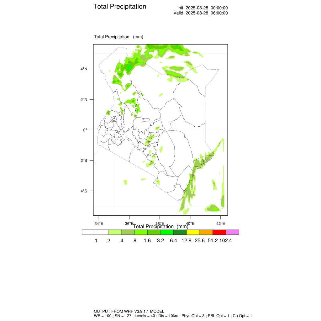
Precipitation forecasts for 28 August - 7 September 2025